
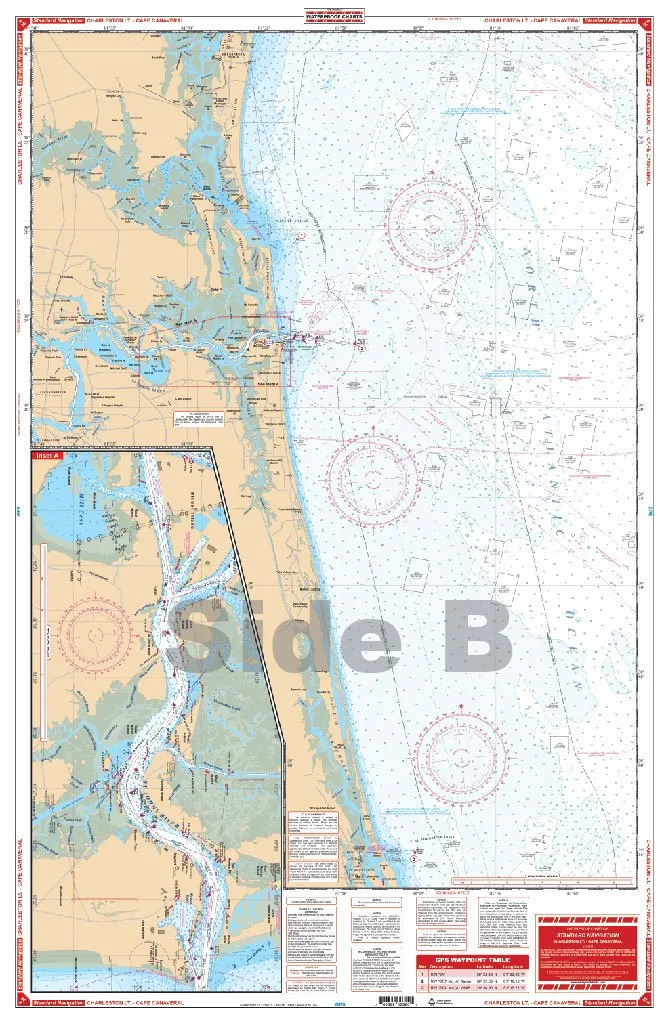
Introducing the Waterproof Charts 36 Charleston, your ultimate companion for seamless navigation in coastal waters. Crafted with precision, these charts are designed to withstand the elements, ensuring that your navigational needs are met, whether you’re a seasoned sailor or a weekend adventurer.
These charts cover the essential routes from Light to Cape Canaveral, providing detailed insights into the waters of Charleston. The waterproof feature guarantees that the charts remain intact, even in the most challenging weather conditions. No more worrying about water damage or fading; these charts are built to last.
| Feature | Details |
| Durability | Waterproof and resistant to wear and tear |
| Coverage | From Light to Cape Canaveral |
| Usage | Ideal for recreational and professional navigation |
With the Waterproof Charts 36 Charleston, you gain more than just a map; you gain peace of mind. Each chart provides comprehensive details, including depth readings, navigational aids, and potential hazards, ensuring that you can navigate with confidence.
Moreover, the charts are printed on high-quality materials that enhance readability, even under direct sunlight. The colors are vivid, and the text is clear, allowing for quick reference while you are on the water. The size of the charts makes them easy to handle yet large enough to provide all necessary information.
Whether you’re planning a day trip or an extended voyage, these charts are essential to your gear. They are not only practical but also a reliable resource that can help you avoid common pitfalls in navigation. Invest in your safety and efficiency with the Waterproof Charts 36 Charleston.
In addition, these charts are environmentally friendly and designed for easy storage and transport. You can take them aboard your vessel or store them safely at home without worrying about moisture damage. The compact design allows for easy packing, making it convenient for any journey.
In conclusion, the Waterproof Charts 36 Charleston are a must-have for anyone who values precise navigation and durability. Their waterproof nature, detailed coverage, and user-friendly design make them an excellent addition to your sailing equipment. Do not miss the opportunity to enhance your navigation experience with these essential charts.


Reviews
There are no reviews yet.